Event Details
When:
-
Location:
Online: Zoom
In-Person at WWU
Academic West, Room 204
Price:
Free
Brought to you by:
College of the Environment, WWU Alumni Association
Description
Check out this video to watch the Environmental Speaker Series Presents: See the Forest Through the Point Clouds Lidar Applications for Ecology.
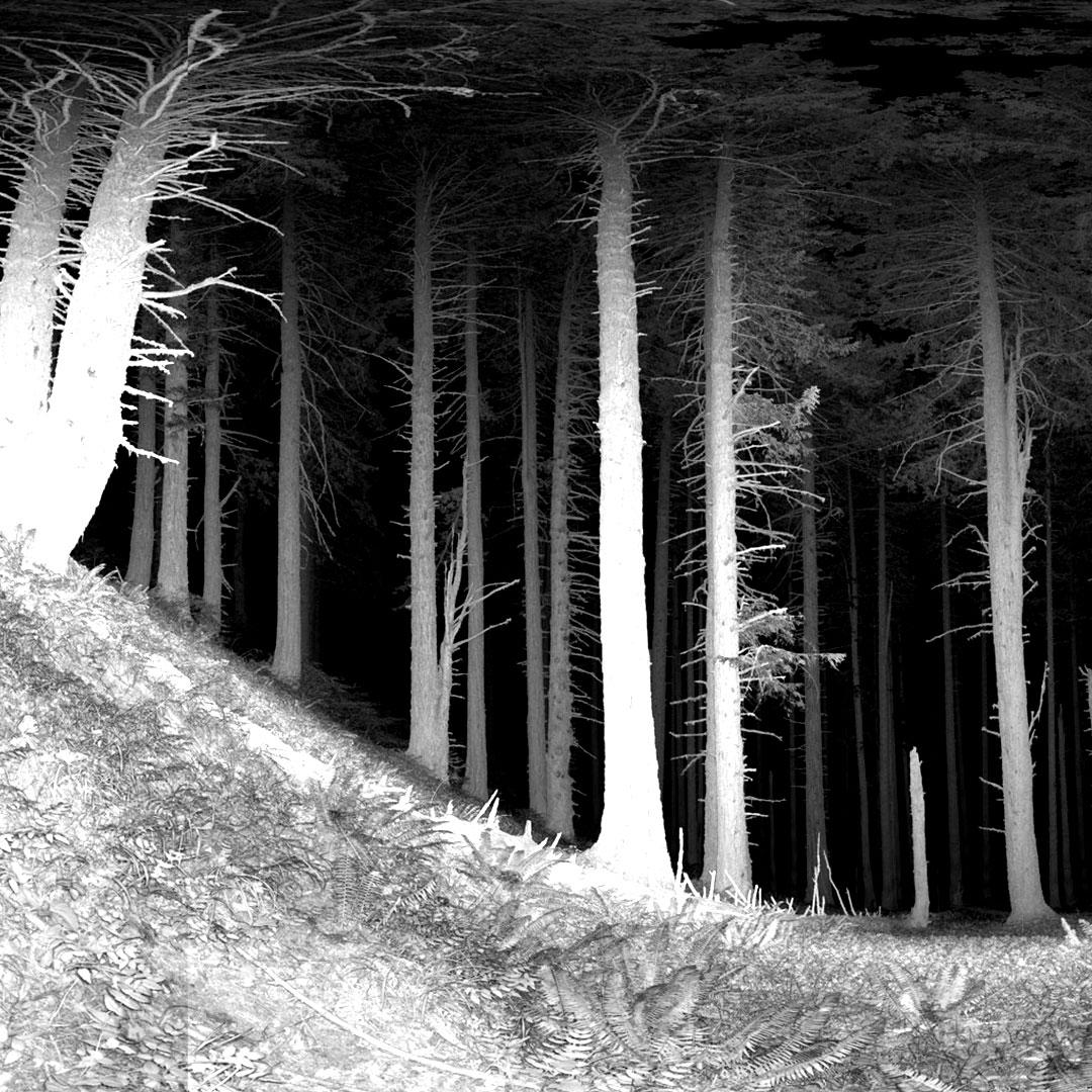
The use of lidar has become a key tool in quantifying important ecological characteristics of forests. Landscape-level airborne lidar acquisitions initially allowed for a level of forest inventory previously impossible. Now with multiple repeat lidar acquisitions over large areas, we are able to model important elements of change such as increases or decreases in biomass and carbon sequestration. Such fine-scale characterizations of the forest allow for the identification of areas that are important for conservation. Where are the biggest trees? How are the trees doing? Where does the forest structure meet important habitat criteria for threatened species? These are all questions that we can get at using lidar, both airborne and terrestrial.
Post-talk, there will be an option for attendees to pose for a group terrestrial lidar portrait.
The Environmental Speaker Series is free and open to the public. Talks are held each Thursday at 4:30pm in Academic Instructional Center West, room 204. Join us at WWU or online on Zoom!
Featuring:
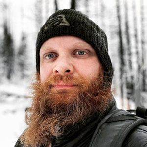
Jonathan Batchelor, Speaker
Jonathan Batchelor (they/them) is a Remote Sensing Geek who dabbles in fire ecology, wildlife habitat characterizations, and restoration processes.
They are a PhD candidate at the University of Washington in the Remote Sensing and Geospatial Analysis Lab under Dr. L Monika Moskal.
Jonathan specializes in fine-scale remote sensing technologies such as drone-based digital aerial photogrammetry and terrestrial lidar. Trees, Drones, and lidar points galore! Current projects are using fine-scale remote sensing techniques to increase landscape-level characterization of vegetation structure regarding fire effects and habitat modeling. These processes involve taking characterizations of forest structure from field-sampled remote sensing techniques and upscaling them to a landscape level using aerial lidar, aerial imagery, and satellite imagery.
Jonathan currently teaches classes on geospatial analysis at the University of Washington, Western Washington University, and The Evergreen State College.
Accommodations and Other Details
Contact the WWU Alumni Association for this event if you have questions or need disability accommodations by calling (360) 650-3353 or emailing Alumni@wwu.edu.
Advance notice for disability accommodations and special needs is greatly appreciated. Please indicate your special needs on the registration form.
There will be auto-captions available for the Zoom webinar.
Limited paid parking is available in the C lots at the south end of campus and in lots 6V and 7G at the north end of campus. Western provides comprehensive parking details—including lot locations, applicable fees, and campus map. Please note that parking in the C lot and 12A by Fairhaven College is free after 4:30pm on weekdays and all hours on weekends.